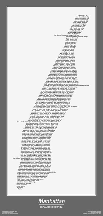
Continuing on Typography, this Axis Map of Boston really is a nice, new fresh idea. I had never seen a map like this until I stumbled upon this site recently. Really creative! (Dear Axis Map, when are you going to make one of Montreal?!)
Typography is something I only got into depth about when I was in "mapping school". As a section in one of our visualisation classes, we would all grumble at how "useless" learning about typography was. Yes, we needed to learn that names of rivers and lakes where to be in Italics and other similar design standards for maps, but learning about when Helvetica and thus the sans serifs fonts were created was always something we laughed about until we realized afterwards how important typography actually is. After seeing categories about typography of Jeopardy! more than once and coming across multiple articles online, I now have a new found respect for typography an typography-obsessed people. In fact, I find it so interesting now that I actually get excited when I come across typography articles. Gosh, have I turned into one of those people? I think I started noticing my own mini-obsession after being e-mailed this page from a former classmate, dedicated the Toronto Subway Typographies.
(Side note: In one of the blogs I follow, the girl is obsessed with the ampersand. I love seeing her updates on ampersand related news. If you don't know what an ampersand is, as I learned that a lot of people don't know it by its proper name, you should Google it. And then use it in a sentence with a friend to feel a lot smarter than you actually are. Like I do. Oops, did I just say that out loud?!).